
They can grow realistic forests in just three weeks!
Since it can take over 1,000 years for a forest to grow, it is not easy to study the effects climate change can have on them and how the forests adapt. Now, Nikolay Strigul, assistant professor of mathematics and statistics at Washington State University, and Jean Lienard, a mathematics postdoctoral researcher, have developed a way to grow realistic forests in just three weeks. How? Using computers.
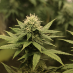
Strigul and Lienard created the first computer simulation that grows realistic forest right down to the branches, leaves and roots of individual trees. They are using the simulation to determine how drought, more frequent wildfires, warmer weather and other climate-related changes will affect forests across North America over thousands of years.
SEE ALSO: This Canadian City is the First to Implement Mandatory Climate Change Warning Labels
The model has already been used to predict increases in forest fire rates and plant growth in some hardwood forests in Quebec, Canada.
“We call our model LES after the Russian word for forest,” said Strigul, who grew up in Russia and came to the U.S. In 2001. “It is a tool that forest managers can use to create 3D representations of their own forests and simulate what will happen to them in the future.”
The LES model is unique because it is the only forest-growing simulator that creates intricate root systems and canopy structures for each tree. Previous simulators could only do one or the other.
It is very realistic: Below ground, the roots of different trees compete for water resources and above the ground, the leaves in each tree’s canopy compete for sunlight. Over time, the trees’ canopies even change shape to expose their leaves to more sunlight.
The researchers used a combination of data from the U.S. Department of Agriculture’s Forest Inventory and Analysis Program and other forestry databases, as well as aerial images taken by drones, in order to customize their model to particular forests.
“In cooperation with the U.S. Forest Service, we developed a method where we fly drones around a forest and take pictures and gather other imaging information,” Lienard said in a press release. “We use this data to develop 3D models that have real distributions of space and ecological features.”
For large parts of North America, climate change is leading to more frequent droughts, and extreme and warmer weather. What effects these will have on forests and their ability to recover from, for example wildfires or clear-cutting, is difficult to predict since there is still little known about what drives forest recovery. The recovery process can take several decades to fully document and involves many trees with different characteristics competing for resources over large areas.
Strigul and Lienard want to use LES to help forest managers determine certain species of trees, as well as other ecological factors, necessary for forests to reestablish themselves after being destroyed.
“Drive an hour east along the Columbia River from Vancouver and you will notice a complete transition from very dense forests to savanna and then to desert,” Strigul said. “The fear is that drier conditions in the future will prevent forests in places like Washington from reestablishing themselves after a clear-cut or wildfire. This could lead to increasing amounts of once-forested areas converted to desert.”
The model can be used to predict if forests are at risk for desertification or other climate-related events, and identify what can be done to preserve and conserve them.
Interestingly, NASA is also look at using satellites to fight forest fires before they start!
Editor's note (February 29): Article was not initially attributed to its author, Joanne Kennell.


Facebook comments